


Four Mile Precinct, Otoe County, Nebraska
About
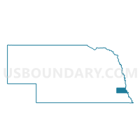
Outline

Summary
| Unique Area Identifier | 613671 |
| Name | Four Mile Precinct |
| County | Otoe County |
| State | Nebraska |
| Area (square miles) | 70.10 |
| Land Area (square miles) | 68.76 |
| Water Area (square miles) | 1.34 |
| % of Land Area | 98.08 |
| % of Water Area | 1.92 |
| Latitude of the Internal Point | 40.70237990 |
| Longtitude of the Internal Point | -95.90251020 |
Maps


Graphs
Select a template below for downloading or customizing gragh for Four Mile Precinct, Otoe County, Nebraska


Neighbors
Neighoring Voting District (by Name) Neighboring Voting District on the Map
- Avoca Precinct, Cass County, NE
- BENTON TWP Voting District, Fremont County, IA
- Berlin Precinct, Otoe County, NE
- Delaware Precinct, Otoe County, NE
- Liberty Precinct, Cass County, NE
- McWilliams Precinct, Otoe County, NE
- Nebraska City 1st Ward, Otoe County, NE
- Nebraska City 2nd Ward, Otoe County, NE
- Nebraska City 3rd Ward A, Otoe County, NE
- Nebraska City 3rd Ward B, Otoe County, NE
- Nebraska City 4th Ward A, Otoe County, NE
- Nebraska City 4th Ward B, Otoe County, NE
- Nebraska City 4th Ward C, Otoe County, NE
- Nehawka Precinct, Cass County, NE
- WASHINGTON TWP W/HAMBURG PART Voting District, Fremont County, IA
Top 10 Neighboring County Subdivision (by Population) Neighboring County Subdivision on the Map
- Nebraska City city, Otoe County, NE (7,289)
- Liberty precinct, Cass County, NE (681)
- Avoca precinct, Cass County, NE (596)
- Wyoming precinct, Otoe County, NE (424)
- Belmont precinct, Otoe County, NE (411)
- Delaware precinct, Otoe County, NE (407)
- Nehawka precinct, Cass County, NE (379)
- Washington township, Fremont County, IA (350)
- Four Mile precinct, Otoe County, NE (338)
- Otoe precinct, Otoe County, NE (259)
Top 10 Neighboring Place (by Population) Neighboring Place on the Map
Top 10 Neighboring Unified School District (by Population) Neighboring Unified School District on the Map
- Nebraska City Public Schools, NE (9,241)
- Syracuse-Dunbar-Avoca Schools, NE (4,454)
- Conestoga Public Schools, NE (4,176)
- Sidney Community School District, IA (2,072)
- Hamburg Community School District, IA (1,671)
Top 10 Neighboring State Legislative District Lower Chamber (by Population) Neighboring State Legislative District Lower Chamber on the Map
Top 10 Neighboring State Legislative District Upper Chamber (by Population) Neighboring State Legislative District Upper Chamber on the Map
- State Senate District 49, IA (60,560)
- State Senate District 2, NE (35,052)
- State Senate District 1, NE (33,429)
Top 10 Neighboring 111th Congressional District (by Population) Neighboring 111th Congressional District on the Map
Top 10 Neighboring Census Tract (by Population) Neighboring Census Tract on the Map
- Census Tract 9669, Otoe County, NE (4,598)
- Census Tract 9660, Cass County, NE (4,301)
- Census Tract 9670, Otoe County, NE (3,008)
- Census Tract 9703, Fremont County, IA (2,571)
- Census Tract 9666, Otoe County, NE (2,128)
Top 10 Neighboring 5-Digit ZIP Code Tabulation Area (by Population) Neighboring 5-Digit ZIP Code Tabulation Area on the Map
- 68410, NE (8,716)
- 51640, IA (1,748)
- 68455, NE (681)
- 68413, NE (533)
- 68346, NE (493)
- 68417, NE (292)
- 51648, IA (255)